Sunday, 23 August 2015

Day 2 - Cleator to Ennerdale Water

We stock up on biscuits and chocolate bars at the local store, then tackle the 300m climb, through forests and over farm land, to the top of Dent Hill.  The weather is clear, and we have good views out over the countryside to the Isle of Man, Scotland, and the picturesque Sellafield Nuclear Reactor.

View looking east (the direction in which we are heading) from Dent Hill

Then down into a Wind-in-the-willows-esque valley.


We have lunch at a country pub in the village of Ennerdale Bridge, then make our way along the side of heather clad Ennerdale Water. 


The Ennerdale valley is apparentlly the least populated in England, and the definition of serenity; all of which make it the perfect place for the RAF to use for training fighter pilots in low altitude flying.  Unfortunately I didn't get any photos of the jets.  By the time we saw them hurtling overhead, they were gone again.

We spent the night at the Ennerdale Water YHA, where I rediscovered why I hate dormitories.

Distance walked today : 18km


Day 1 - St Bees to Cleator

I have a full English breakfast to start the day.  To help preserve my trim post Lycian Way physique, ruined only by a month of extreme tapas eating in Spain, I skip the toast and stick to sausages, bacon, eggs, etc.  The plan is to have lunch at midday at a pub in Sandwith that is mentioned in the Coast to Coast guidebook. We start the day with a 700m walk from St Bees down to the beach, pick up the traditional peeble (to be deposited on the opposite coast at the end of the walk) and get underway in fine weather.  The first part of the Coast to Coast is a walk along cliff tops.  It is prime bird watching territory, and with our newly purchased binoculars we manage to identify: gulls, gulls, and more gulls.

Not Broadchurch

We reach Sandwith at 1pm ready for a big lunch, but the pub that the guidebook describes as "open 7 days" is closed on Mondays, and of course it is a Monday, and there is no where else in the village to buy any food.  

After 10 minutes spent licking a wooden picnic table for nutrition, we decide to press onto the next village where the guidebook informs us a bakery and cafe await.  Fifty minutes later we reach the next village.  The bakery is shut and the cafe has gone out of business.  My plan is to catch and spit roast a cat, but Fiona convinces me to press onto the next village.  It is 4pm before we find anywhere selling food.  Not the best of starts to our walk.

Lesson's learnt today:

1) Carry some food with you, even if you think that you will have numerous dining options along the way

2) Don't trust the guidebook

3) In Britain - dogs grow in planter boxes


Distance walked today - about 15km

Monday, 17 August 2015

Day 0

After two months in Turkey walking the Lycian Way, and a month in Spain eating tapas, we have relocated to Britain; meaning that day time temperatures have gone from 42 degrees


to something in the 15 to 19 range.


Over a few days we make our way to St Bees, the start of the Coast to Coast walk.  Three hundred kilometres from the Irish Sea, across three national parks, to the North Sea.  It is now mid August. We will be walking a little after the peak of summer, but the school summer holidays start in mid-July in England, and we hope that by starting a month later we can avoid the peak season crowds.

As preparation we've walked the Lycian Way; 500km up and down mountains in Turkey.  Our instinct is that the Lycian Way should be plenty of preparation for the Coast to Coast, but we completely under-estimated the Lycian Way and are determined to not make the same mistake twice; so we are trying to avoid making too many assumptions with regard to our levels of fitness for the Coast to Coast.  The Coast to Coast typically takes between 14 and 19 days of walking.  Or goal is to enjoy the walk as much as possible, rather than complete it as quickly as possible.  To this end we plan on starting out slow, and then seeing how much scope there is to speed up.  Fiona's back is a bit twingy, but this is the only injury that we are starting with.

We've got basically the same gear that we used in Turkey, except that I've replaced my boots after the Lycian Way destroyed the previous pair, and we've swapped the lightweight raingear that we had in Turkey for some much sturdier coats.

An important difference between the Lycian Way and the Coast to Coast is that on the former we had to carry all of our gear on our backs (31kg between us on a bad day), but for the Coast to Coast we are utilising the services of a company that picks up our gear in the morning and drops it at our next destination in the afternoon.  This means that we are only carrying 10kg between us during the day.  The only downside of utilising the services of the pack carrying company is that it does largely preclude  the option of wild/freedom camping (which we so enjoyed on the Lycian Way).

We've got to St Bees without any great drama.  The biggest thing that went wrong was that we were relying on a bus to get us from Whitehaven to St Bees, as described in the Coast to Coast guide book, but when we got to Whitehaven we discovered that the bus service had been decommissioned; so we caught a taxi.

We've researched which mobile phone networks have the best coverage on the Coast to Coast route, and purchased a British SIM card for each of our phones.  We've opted for two different networks to maximise the chance that one of us will have coverage.  

Anyway, we are now in St Bees and ready to start the Coast to Coast tomorrow.  In high season people are advised to book all of their Coast to Coast accommodation in advance.  We feel that this would constrain the timing of our walk too much, so we have only booked the first 4 days in advance.  It will be interesting to see how booking accomodation on the go works out.

Final preparations - carbo loading with cheese cake and sticky date pudding - the desserts of champions.


Sunday, 16 August 2015

11. Segura de al Sieraa

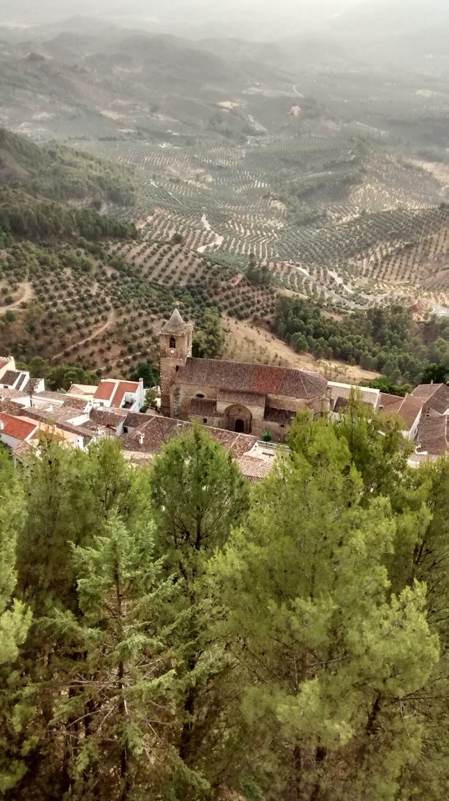
From Cordoba we moved east to Segura de la Sierra (red flag) below. We chose Segura for access to walking tracks, wanting to keep our fitness up and wear in Kim’s boots before the Coast to Coast walk in England.  


We discovered that Segura was a cute village positioned a steep hill surrounded by lots of cliff faces, with a big castle perched right on the top. When we located our accommodation among the tight, twisty, narrow streets, we found we were right below the castle grounds.


Segura de la Sierra had lots of interesting sites to check, and despite the 40’C heat we kept a pattern of walking in the morning and visiting sites at about 6pm when it was cooler prior to our late Spanish dinner. The castle had been extensively restored and presented for tourists. Additionally there were Moorish baths, a Jesuit church and various historic gates and walls to emphasize the long history of the town.

On the last day, some
cloud
rolled in
preceding a thunder storm

To our delight, several Spanish ibex (think mountain goat) were grazing each morning and evening on the grassy area between our accommodation and the castle, unconcerned about humans passing by.


The downside of Segura was accommodation with tissue thin walls, so we were short on decent sleep. This was accentuated by the hot night-time temperatures. Our hosts told us that the average temperate this summer was 10’C higher than last summer – although last summer was slightly cooler than average. When locals have enough English to interact with us, they complain about the relentlessly hot weather; it seems they are not enjoying it any more than we are. In Segura we were out of tourist territory and everything closed for siesta between 2 and 7 pm. So if we forgot to buy food before 2pm, we had to improvise from existing supplies or go hungry. All in a day’s tourist work.

Wednesday, 5 August 2015

10. Cordoba and the Mezquita

Cordoba's earliest inhabitants pre-date the Bronze Age, so things have been happening here for a fair while. In Roman times, Cordoba was the capital of a Roman province and home to Roman philosophers such as Seneca. The ruins of a Roman temple were just round the corner from our abode. Ancient churches are on almost every street, but the most famous site of all is the Mezquita, the Mosque-Cathedral of Cordoba, and it was high on our list of places to visit. It's thought that the first place of prayer built on the Mezquita site was an early temple. It's certain that a Christian church was erected on the site by the Visigoths in the C7th.  Some remnant pieces of this building are on display, the artistry of which made Kim comment that the Visigoths were obviously much less barbarian than we assume, and clearly needed a better PR team.

The Muslim Moors conquered the area in 711 AD, and Visigoth church was first divided into Muslim and Christian halves; an arrangement that lasted for over 70 years until the Christian half was purchased by the ruling Muslim Caliph of the time. In 784 AD, work to build the Great Mosque (the Mezquita) on the site began, and improvements continued for two centuries.


Cordoba is thought to have been the biggest city in the world by 1000 AD, with a population of a quarter of a million people, plus numerous libraries,  universities and medical schools (which established some medical techniques that were only superseded in the C20th). As the most prosperous city of Europe, it outshone Byzantium and Baghdad. According to the Rough Guide to Andalusia, the Mezquita had an original copy of the Koran and as a place of pilgrimage, it ranked fourth in sanctity after Mecca, Medina and Jerusalem. Eventually however, things declined and, in 1236, the Reconquista saw Cordoba reclaimed by Christians from the North.  The Mezquita was turned into a Cathedral, and later an apse placed in the middle. Happily the orange tree courtyard was retained (Kim and I are now official fans of orange tree courtyards); as were other features intrinsic to the building like the great halls of pillars.


Recently, Muslims across Spain have lobbied the Roman Catholic Church to allow them to pray in the complex, with the Islamic Council of Spain lodging a formal request with the Vatican. However, (according to Wikipedia) Spanish church authorities and the Vatican have opposed this move.

The Mihrab or prayer niche. It survived unchanged after being bricked up
following the Christian Reconquista, 1236, and only rediscovered in the C19th. 


The Mezquita stands beside a restored Roman bridge which spans the Guadalquivir River. At the other end of the bridge is the Tower of Calahorra. The very well presented historic material in the Tower has a strong pluralist theme, including highlighting quotes from historically prominent Jewish, Muslim and Christian leaders/thinkers connected to local events. Most of the quotes point up religious tolerance and inclusion, plus the audio guide has other pithy lines, which are not referenced, such as: the centre of God is everywhere and the circumference is nowhere.


Reading the history of the Mezquita had made an impression on me. Also, I had been keen to see Moorish architecture in Andalusia, and was a bit disappointed by the lack of it prior to Cordoba. Some of the most important examples are retained at the Mezquita. Our visit to the Mezquita site, the current Catholic Cathedral, had the usual context of tourists posing for selfies, and the cleaner with a mop entering the gates which lock off the current worship area when not in use for Mass. Plus, there were no information boards about Mezquita's history, which I thought was sad. So it was easy to miss a whisper of immense presence and story. Perhaps the focus in this blog is my response.


The Andalusian Sufi mystic and poet, Ibn Arabi (1165 - 1240), born near Cordoba, wrote

My heart has become capable of every form:
it is a pasture for gazelles and a convent for Christian monks,
a temple for idols and the pilgrim's Kaa'ba,
the tables of the Torah and the scrolls of the Quran.

I follow the religion of Love:
whichever way Love's camels take,
that is my belief, the faith I keep.


Sunday, 2 August 2015

9. The road to Cordoba

Our road trip to Cordoba was typical of how things roll for us here. Earlier, en route to Casares, we had tried to take a ring road to divert us from the centre of the tourist town of Ronda. But no, despite our efforts we ended up in Ronda's clogged main streets, and saw a historic bridge apparently above a canyon. We didn't stop for lack of car parks and the imminent timing of an All Black test. Now we were returning back past Ronda en route to Cordoba, so we thought we'd go through town (again) but, this time stop and take a look at the bridge and canyon. Ah yeah, despite our best efforts we ended up on the diversionary ring road, and decided Ronda would keep for another trip to Spain one day.

Fiona randomly chose a town beside a lake for our lunch stop. Serendipitously, the lake (lagoon) was Spain's biggest breeding ground for flamingos and had a good visitor's centre with lookout points and screens with images from a fixed camera out on the lagoon. We had visited the edge of Donana National Park near Sanlucar, and had heard of this breeding area as the birds fly a 350 km return trip each day to get food from Donana to bring to their young at Fuente de Piedra Lagoon.

Fuente de Piedra Lagoon was also important for nailing a trifecta! Kim's Lycian Way blog records our observations of tortoises and turtles in Turkey. At Fuente de Piedra Lagoon we spotted several terrapin, the third member of the Testudines family of reptiles. These fellows were swimming in a pond and didn't pose well for photo shots but we were excited.

Historic area of Esptepa which we
 visited en route to Cordoba.


Our terrapin for the Testudines reptile trifecta.


Then, prior to the final leg up to Cordoba, Fiona's choice of a 'town with a castle or tower' to visit turned out to be one of the few towns with a historic area which you could drive right up to and - lo and behold - had parking in the shade freely available. So we were feeling good about Cordoba before we even arrived, and it didn't stop. Our Airbnb host had arranged a staff member to meet us near a motorway off-ramp, and then guide us - including through the 'narrowest street yet' - to our lodging and underground car park in historic Cordoba.

View of Cordoba - we are lodged beyond
the tower in the background.

Thursday, 30 July 2015

8. Casares and Gibraltar

From Jerez we headed east through the Sierra de Grazelema Natural Park to a rural setting just outside of the small village of Casares (located at red dot below).


We had lunch in very picturesque village of Grazelema - mid north in the Sierra de Grazelema park.

Grazelema from the top of the village


The drive down to Casares, through undulating rocky hills, was more scenic than the area west of the park where we had been.


Our new abode for six nights (again booked through Airbnb) was an old stable, renovated into a couple of cottages, located on an Appaloosa horse stud. But priority one on arrival (while the owner fixed the air con), was watching the rugby test - NZ All Blacks against the SA Springboks. Nice one ABs!

Things are very dry on the horse stud. See white cottage where we are staying in background


Since being here we have explored the local village, visited Gibraltar and done a three hour walk to remind our bodies that walking is on the agenda when we get to Britain.

Casares village - the skyline of the village illustrates the ancient and new buildings merged into each other;
this is a common occurrence in the villages we've visited


There's a very large kettle of Griffin Vultures living
in this valley. When we were out walking,
 they hovered overhead, waiting to see when
the sun might overwhelm us.
We drove down to visit Gibraltar, which included a tour through the WWII tunnels and earlier tunnels from the Great Siege in the 1780s. The Great Siege lasted three and a half years, while Britain held the Rock against Spanish - French offensives. It turns out the eighteenth century tunnels are better made and are surviving in better condition than the WWII tunnels.
Gibraltar 'The Rock' - looking north

Gibraltar with the coast of Africa on the horizon

A cute aspect of the restricted space on Gibraltar is that the road in from Spain runs across the airport runway. We parked in Spain, walked into Gibraltar and caught a bus into town.  Therefore we bus-ed across the runway.
The border between Spain and Gibraltar is a couple of hundred metres past the runway. On our way into Gibraltar, passports were waved vaguely towards border officials, as the tourist hordes streamed in. On our way back into Spain, there was not even any passport waving.

For the first time, the Spain blog is up to date. Tomorrow we head north to Cordoba.


7. Jerez and around


We picked a rental car in Seville and drove south to Jerez. We soon found that having the air con on the coolest setting and full fan doesn't make a car cool in an Andalusian summer.


Jerez was a relaxed sort of place, more good tapas and not too many tourist sights that seemed compelling. But we also wanted to check out the surrounding area. We had been impressed with our navigation getting out of Seville and into Jerez, and pleased with the Renault Captur car that Avis produced - a size bigger than we had booked.  However, trips to Cadiz, Sanlucar and the famous white villages of the area soon taught us the frustrations that easily abound when driving here:
  • one way streets - almost every street that's not the motorway is one way, and you can't trust the map you are using to have placed the arrow in a direction consistent with reality
  • narrow, one way streets with alarmingly tight turns and sharp descents, where you pull in your wing mirrors, implore the navigator to direct you to a wider street, and wish you had the tiny rental car you had booked
  • roundabouts with haphazard lanes where you find yourself forced off your intended route into yet more narrow, one way streets, unable to find a route back.
Just proving we did make it to Cadiz - in the end

In case you wondered what a beach in southern Spain looks like when not
obliterated by a mass of cheap and ugly hotels.


The Huffington Post has an article on Discovering Spain's Charming Ancient White Villages which  notes: "A driving tour to Andalusia's pueblos blancos, or white villages, is a highlight of any trip to Spain — as long as you don't try to drive through them." huffingtonpost.com/2013/11/01/spains-white-villages

Arcos de la Frontera - one of the white villages we visited


Advice on walking the Lycian Way


This section is intended for anyone thinking about walking the Lycian Way.  We walked the Lycian in May and June 2015; from Ovacik to Geyikbayiri.  In the places where there was a choice of coastal or inland route, we took the inland route.  We did not do the side trip to Trysa. Fiona took a dolmus (local bus) on those sections where the guidebook suggested taking a dolmus (e.g. from Finike to Karaoz).  I walked every ****** step ;-)


What was good?
  • Great scenery
  • Lots of interesting historic sites
  • Plenty of wildlife (if you keep your eyes open)
  • Great people.  This was the big surprise for us.  The locals that we meet along the way were fantastic.
  • And it was unpredictable enough to still be an adventure


How hard was it?

I don't know how to answer that, as I don't really have anything to compare it with.  I walked the Annapurna Circuit many years ago, and I don't remember that being as hard as the Lycian Way; but I was a lot younger then.  Some indication of how hard the Lycian is might be gained from the fact that we both finished the walk weighing about 8% less than when we started.


But, we walked the whole thing, and most people don't.  One of the good things about the Lycian Way is that it varies greatly, and there are sections suitable for almost every level of fitness.


What is the path like?

The route tends to stay off roads, and instead take rural or forest paths.  In places the paths are clear, in places the paths are overgrown.  In places the paths are wide, in places narrow.  In places steep, in places flat.  The only thing that is largely consistent is the stones.  Anatolia is the stoniest place that I've ever been, and the stones are very tough on both feet and footware.


How easy is it to follow the path?

The answer to that is complicated.  The short version is that it is very easy to follow the path in the sections that are popular, but there are a few sections that are almost unmarked, and there is everything in between.  There is a full explanation in another post on this blog.


How much do you need to carry?

That depends on your approach.  If you want to walk the entire 500+ kilometres - there are a few sections of the route where there is no accommodation.  For these you need to either carry a tent and sleeping gear etc, or you need to be confident that you can cover 35km (gaining and losing 1800m) in one day.  We took the tent approach.  That left us dividing 23kg, excluding food and water, between two people.  The amount of food / water that we carried varied greatly.  On the stretches with a long way between water sources, we carried 6 litres of water between us.  Add another 2kg of food, and on a bad day we would be carrying 31kg between two people.

If you don't want to walk the entire 500+ kilometres - there are almost endless ways that you can divide the Lycian Way up into a series of day walks carrying only a day pack.  If I wanted to do it this way, then I would:
1) Identify a series of places that I wanted to stay along the route, at towns/villages that were dolmus (local bus) transport hubs.
2) Then stay in one place for 4 to 6 days, each morning catching a dolmus to the start of the next section that I wanted to walk, and then catching a dolmus home in the afternoon.
3) Then relocate my accommodation to the next place that I wanted to stay, once I had completed all of the sections that were accessible by dolmus from the current accommodation.
I suspect that it would be possible to do over 75% of the route this way.


Are there any miss-able sections?

There are a few places were the creators of the Lycian Way struggled to find a good way to connect the interesting bits of the route together.  Anywhere in the guidebook where you see a comment along the lines of "or you could take a dolmus", is a strong hint that there is nothing to be seen on this section and you really should take a dolmus.  I thought the following were (easily) the least interesting sections of the Lycian Way:
- Pydnai to Kinik
- the stretch through Demre (stop at Andriake; then start again at the base of the mountain section, a couple of km west of Demre)
- Finike to Karaoz (the final 8km into Karaoz is OK, but the rest has little to recommend it).

That removes the most unrewarding 2.5 days from the route; unless you are a big fan of tomato hothouses, in which case you should make sure that you walk all of the above.

Beware of everything that you read / are told.  I had several walkers tell me that they were not going to walk the section immediately east of Kalkan because they had read that it went along the side of a motorway and was dangerous.  This turned out to be untrue.  The marked route crossed the motorway on a footbridge, then followed a path up into the hills.


How many other walkers are there on the route?

One of the things that attracted us to the Lycian was that we wanted to avoid crowds of walkers, and we were not disappointed.  On a busy day we would encounter about 10 other walkers, but there were a lot of days when we saw no other walkers.

Crowds on the Lycian


What is the weather like?

When we were doing the walk (May and June) the hottest part of the day tended to be in the mid twenties to low thirties.   Thankfully we finished before it got any hotter.  The days when it was overcast were very welcome.

The nights were hot in the coastal areas and cold in the mountains.

We had several people tell us that it would not rain after mid-May, but that was untrue.   It rained about one day in ten after mid-May, although for only a few hours on those days.

Eating inside the tent because it was raining outside
(in mid June).


Are there any dangerous animals?

There is a bit of chatter on the internet about dogs, snakes and scorpions on the Lycian.

Dogs - The Turkish shepherd dogs are huge and look intimidating, but we had no significant problems with them in rural areas.  As working dogs, they are generally disciplined and well trained. The places that we had trouble with dogs were on the outer edge of towns/villages.  Here we encountered a mix of poorly disciplined domestic dogs and "junk yard" dogs. By the end of the walk I'd had enough bad dog experiences on the edge of towns/villages, that I would pick up a handful of stones before entering these areas.   Turkish dogs are smart.  I would just show them my handful of stones and they would back off.

Nice doggie... nice doggie...


Snakes - we saw a dozen, and I suspect that there were a lot more that we didn't see.  I have no idea whether the snakes that we saw were dangerous or not, but a local told me that the snakes were "mostly harmless".

In general snakes do not hang around for photos


but there are exceptions to every rule.

Scorpions - We saw no scorpions.  We were told that they were around, but despite (carefully) lifting up hundreds of rocks (to clear space for the tent) we did not encounter any.


Things that I would do differently next time
  • I would take tougher footware.  I was wearing North Face Havoc boots, and Fiona was wearing Keen Targee shoes.  Both choices were too light for the Lycian Way.  Our feet took a pummeling, and I estimate that by the time we finished the walk my boots had about two days life left in them.  If I had my time again I'd take boots with a full leather upper (as recommended in the Lycian Way guidebook) and a very solid shank.  I did see a few people doing day walks on the Lycian in sports sandals, and they all looked miserable.
  • We started on 7 May, but if I had my time again I would try to start two weeks earlier.  The weather would be a little bit cooler, but it should still be late enough in the year for the snow to have melted in the mountains.
  • I'd camp out more.  The freedom camping in Anatolia is excellent.


Things that we got right 
  • The main thing that we got right was having no specific time constraint.   We didn't have a lot of fitness at the start of the walk, but having no time constraint allowed us to finish the whole walk, and enjoy (most of) it.
  • Taking multiple navigation aids, including two smartphones with GPS and high resolution offline maps.
  • Taking an ultralight tent and camping gear.
  • Taking bottles to carry up to 6 litres of water.  We usually started each day with only three litres, but there were times when we needed to carry the full six.
  • Taking Oral Re-hydration Salts.  Note that you can buy these in the major towns in Turkey, but the packets that we brought from home tasted much better.
My salt; not where it should be.


What was the most disappointing thing about the Lycian Way?

The finish was a bit of an anti-climax; it was just a dusty road in a dusty town.  In an ideal world the Lycian would finish somewhere that was more of an event in itself.  Maybe finish on top of Mt Olympus (the highest point on the route) and then take the cable car down?


What did it cost?

Accommodation and food etc cost us approximately 155 Turkish Lira (USD55) a day; but we camped about 1/3rd of the time which saved us some money.

There is no fee to walk the Lycian Way, but we made a donation to the Cultural Routes Society. They use donations to maintain and improve the route.


Anything else?

I would hesitate to recommend doing the entire Lycian Way to anyone that was afraid of heights, as there are a few places where there is a steep drop-off on one side of the path.   However, in most of these places there was an alternative road that avoided the exciting bits.

The path is almost a metre wide at this point,
but it is a long way down.


And the Lycian Way should be renamed "The Goat Way".  Sure, there are a lot of Lycian ruins, but there are a heck of a lot more goats.


Wednesday, 29 July 2015

6. Seville - more amazing places

We're not the types to head off to a bull fight, but having seen the bull fighting arena from the Cathedral bell tower, we decided a visit to the site was needed. It turned out that entry to the building included a guided tour. So we learnt the inside details about bull fighting (eg only two bulls have been set free in the last fifty years - this favour is granted by the president of the fight if he thinks the bull fought exceptionally well). The colours in the arena were ... well you can see for yourself.


Inside was plenty of artwork -
a painting giving a taste of the action sometime ago

And... another severed head - what is it with Seville and decapitations?

Two other amazing places where we spent time, were the Plaza de Espana and the Museum of Contemporary Art.  The latter was housed in what used to be the Santa Maria de las Cuevas Monastery, built in the C15th.

Entry area for Contemporary Art Museum, aka Santa Maria Monastery


We adored the expression of Spanish architecture at Plaza de Espana (below), initially assuming it was an old site that had been very well done up, before realising it was built for the Ibero-American World Fair in 1929. They must have had a huge budget.


You can tell how hot it must be by the absence of other tourists...
And attention to detail was everywhere
The arches were captivating